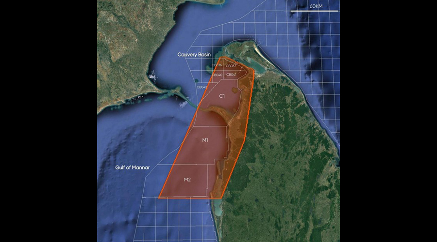
The mapping project was conducted during the last quarter of 2021 as part of a collaboration between Bell Geospace and the Government of Sri Lanka, with the aim to explore offshore oil and gas potential in the seas off the North and Northwest of the island.
This entailed the acquisition, processing and interpretation of data from Airborne 3D Full Tensor Gravity Gradiometry (FTG), Gravity Gradiometry, and Magnetic Surveys that were employed to gather data on hydrocarbon potential below the surfaces around the Cauvery Basin off the Northern peninsula and the Mannar Basin off the West coast.
Data and interpretationfrom this survey has revealed new insights into the structure, tectonic history, and hydrocarbon potential of Sri Lanka’s Mannar Basin M1, M2, and the Cauvery Basin C1 blocks.
With Sri Lanka outlaying US$ 6-7 billion annually to purchase fuel, and the domestic hydrocarbon potential estimated at several billion barrels of oil and 9 trillion cubic feet of gas, this is a potential multibillion-dollar revenue stream for the Government of Sri Lanka.
Especially taking into consideration that Cairn India, which explored the Mannar M2 block, invested US$200 million in the region 10 years ago.
Additionally, with Bell Geospace’s modern geophysical data and interpretation, the publicity created at a major Oil and Gas conference such as SEAPEX in London holds the potential for Sri Lanka to attract a new round of foreign investors bringing in US$ to the country.
US-based Bell Geospace is the leading provider of high quality airborne Full Tensor Gravity Gradiometry (FTG) data for the mining industry.
This data is used to map geology and thus define the shape and scale of existing mineral deposits as well as highlight potential new areas of exploration.
Wintermoon Geophysics is a premier consulting firm for integrated exploration applications of Gravity, Magnetics, GIS, and Remote Sensing.


